PISMA-WP: Platform for Intelligent Socio‑Environmental Monitoring and Analysis
 Fusing data for socio-environmental indicators
What is PISMA-WP?
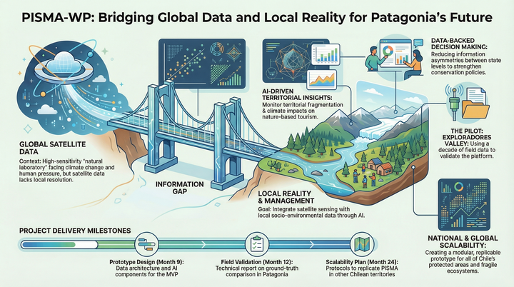
PISMA-WP is an Avanza UC research project that pilots a socio-environmental monitoring platform in the Exploradores Valley at UC’s Patagonia Station. It integrates open satellite imagery with local environmental instrumentation and socio-territorial indicators to produce actionable, explainable metrics for territorial planning and conservation.
Why it matters
Relying only on remote sensing limits local relevance and resolution. PISMA-WP addresses this by combining Earth observation with ground measurements and social signals under a FAIR-aligned governance model, improving reproducibility, traceability, and decision usefulness for regional stakeholders.
Objectives
- Design data and governance architecture with reproducible ingestion, metadata, versioning, and a catalog of indicators with full lineage.
- Implement multimodal fusion and explainable modeling with uncertainty quantification for priority processes.
- Validate the prototype in the field and benchmark against current baselines to assess technical and operational value.
Methods and architecture
- Multimodal data cube: satellite, climate, cartography, administrative records, mobility/text data, and station time series aligned in space and time.
- Explainable GeoAI: models with feature importance, calibration curves, and uncertainty bands, evaluated with spatially aware validation.
- APIs and viewer: versioned access to indicators and time series for analysts and decision makers.
- Governance and FAIR: quality checks, provenance, roles and access policies, ethical safeguards, and documentation for reuse.
Deliverables
- Published variable and metadata catalog.
- ETL pipelines with orchestration and data quality controls.
- Model components for change detection, fragmentation, and tourism-climate interactions.
- Prototype API and web viewer in the test environment.
- Governance, security, ethics, and operations policies approved.
Pilot and validation
The pilot focuses on the Exploradores Valley with:
- Technical validation: metrics, thresholds, and reproducible results; temporal and spatial blocked cross-validation.
- Field validation: control points and local sensor comparisons.
- Operational exercises: user studies with regional actors to test usefulness, time-to-insight, and adoption barriers.
Connection with SAVIIA
PISMA-WP leverages SAVIIA as a backbone for hybrid local–cloud data governance and reproducible pipelines, enabling scalable integration across RCER stations.
PISMA-WP advances applied GeoAI for territorial management by operationalizing multimodal fusion, explainability, and uncertainty on top of governed, FAIR-compliant data workflows, so local decisions can rely on transparent, reusable evidence.
Project Team:
- Reseearchers: Alejandro Salazar, Rodrigo A. Carrasco
- Students: Sabina Lemunao